


2011年度 カリキュラム
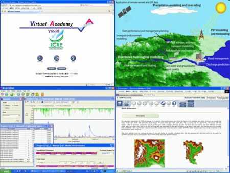
Basic River Basin Hydrological Simulation
Advanced River Basin Hydrological Simulation
Landslide hazard zonation using GIS techniques (New from 2011) *
* スリランカ Ruhuna大学 Silva G.H.A.C. 先生との共同で開講いたします。 ここに Silva G.H.A.C. に感謝の意を表します。
Eラーニング(ウェブベースで行います)
カリキュラム
Basic River Basin Hydrological Simulation
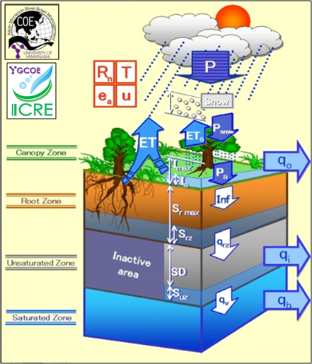
- Lesson 1. Overview of Hydrological Models
- Lesson 2. What's YHyM/BTOPMC?
- Lesson 3. Digital Elevation Model (DEM)
- Lesson 4. Precipitation & Discharge Data
- Lesson 5. Soil & Land Cover
- Lesson 6. Potential Evapotranspiration
- Lesson 7. YHyM/BTOPMC Parameterization and Application
Advanced River Basin Hydrological Simulation
- Lesson 1. Overview of Hydrological Models
- Lesson 2. What's YHyM/BTOPMC?
- Lesson 3. DEM Processing
- Lesson 4. Precipitation & Discharge Data
- Lesson 5. Potential Evapotranspiration
- Lesson 6. Snow & Soil Freezing
- Lesson 7. Parameterization
- Lesson 8. Running YHyM/BTOPMC
Landslide hazard zonation using GIS techniques (New from 2011)
*内容および開講時期については、UY-GCOE Communication Space (仮称) よりアナウンスされます。